Here are some projects I have worked on.
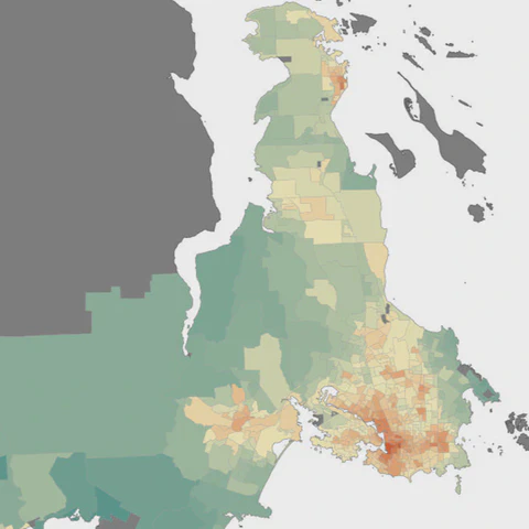
This ongoing project maps how social inequalities shape the risk of road traffic injuries across neighborhoods in British Columbia. By combining census data, crash records, and spatial modeling, it highlights patterns of deprivation and injury risk—especially for pedestrians and cyclists—to inform safer and more equitable urban planning.
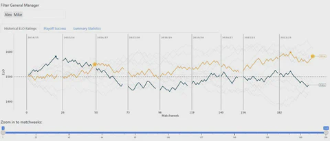
A fun and interactive Shiny app that tracks and visualizes ELO scores over 11 seasons of fantasy hockey for participants in a head-to-head league among friends. Impact: Makes competitive tracking intuitive and enjoyable for everyone in the league.
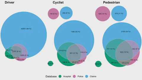
This report was prepared for decision makers and policy makers in the provincial government to support goals of increasing active transportation while striving for Vision Zero. It uses linked datasets encompassing insurance claims, police reports, hospital admissions, and sociodemographic information to describe changes in road traffic injury rates over time, identify population groups with higher rates, and discern factors that influence injury severity.
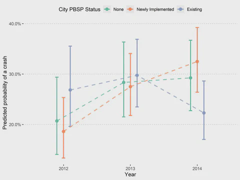
This project evaluated how implementing public bicycle share programs (PBSPs) affected the likelihood of bicycling collisions across multiple North American cities. Using a difference-in-differences approach applied to repeated cross-sectional survey data, it shows that crash odds did not increase after PBSP implementation and were notably lower in cities with existing programs, supporting the safety of well-established bike share systems.